
We may earn a commission from links on this page, at no cost to you. Disclosure
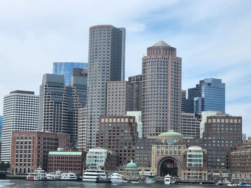
Boston Harbor is the body of water on the city's east side, opening into Massachusetts Bay between Deer Island to the north and the long arm of Hull to the south. For a visitor, the harbor is the downtown waterfront: walk to Long Wharf, next to Aquarium station on the Blue Line, and you are on it, with the island ferries, the New England Aquarium and the Harborwalk all within a few minutes on foot.
The rest of this guide explains which Boston neighborhoods face the water, how to get out onto it, and what changes with the season. Every fact was checked against official sources on October 1, 2026.
Where exactly is Boston Harbor?
The harbor wraps around the eastern edge of the city. Downtown, the North End, Charlestown, East Boston, the Seaport, South Boston and Dorchester all have harbor frontage, and Logan Airport is in East Boston, across the water from downtown. Farther out, the outer harbor holds the 34 islands and peninsulas of Boston Harbor Islands National and State Park. The National Park Service describes it as a famously complicated harbor to navigate, with shallow channels, submerged bars and strong currents.
There is also an unincorporated community called Boston Harbor in Washington state; if a map app sends you to Olympia, that is why.
Which Boston neighborhoods are on the harbor?
| Waterfront area | What is there | Getting there |
|---|---|---|
| Downtown Waterfront | Long Wharf ferries, the New England Aquarium, Rowes Wharf | Aquarium station, Blue Line |
| North End | Christopher Columbus Park, Battery Wharf | Haymarket, Orange and Green lines |
| Charlestown | Charlestown Navy Yard and USS Constitution | MBTA ferry from Long Wharf, or walk from North Station |
| Fort Point and Seaport | Boston Tea Party Ships, the ICA, harbor-view restaurants | Silver Line to Courthouse or World Trade Center |
| South Boston | Castle Island and Fort Independence | Car, bike or bus |
| Dorchester | JFK Library at Columbia Point | Red Line to JFK/UMass, then free shuttle |
| East Boston | Logan Airport and harborside parks | Blue Line |
The Downtown Waterfront is the easiest base: the New England Aquarium on Central Wharf is about 100 yards from Aquarium station, and the harbor seal exhibit on its front plaza is free to anyone walking past. Hotels that put you directly on the water include Boston Harbor Hotel at Rowes Wharf, Boston Marriott Long Wharf and Battery Wharf Hotel in the North End.
Walk the Boston Harborwalk
The Boston Harborwalk is a near-continuous public path along 43 of the city's 47 miles of shoreline, from the Neponset River in Dorchester to Constitution Beach in East Boston, by way of Charlestown, the North End, Downtown, the Seaport and South Boston. You do not need to walk all of it. The most rewarding first-timer stretch runs from Christopher Columbus Park past Long Wharf and Rowes Wharf to the Fort Point Channel, where the Boston Tea Party Ships & Museum sits on the Congress Street Bridge, then along the Seaport to the Institute of Contemporary Art, whose galleries cantilever out over the water.
How to get out on the water
Harbor Islands ferries. Public ferries leave Long Wharf North for Georges Island, with Fort Warren, and Spectacle Island, with its hilltop view back to the city. They run only from mid-May to mid-October, and October 12 is the last day of the 2026 season. The park charges no entrance fee; the round-trip ferry is the only cost.
The Charlestown ferry. The MBTA runs a year-round ferry from Long Wharf to the Charlestown Navy Yard, which makes a cheap harbor crossing to USS Constitution and its museum. Boarding the ship is free and first come, first served; everyone 18 and over needs photo ID at the security checkpoint.
Cruises and whale watches. Sightseeing cruises and whale watches also run from the downtown waterfront in season. Our guides to things to do in Boston on the water and whale watching from Boston compare the options. For meal cruises and sunset sails from the waterfront, see our guide to Boston harbor dinner, lunch, brunch and sunset cruises.
Harbor history in three stops
The Boston Tea Party took place on December 16, 1773, in the same stretch of water now crossed by the Congress Street Bridge. USS Constitution was built at Edmund Hartt's shipyard in the North End and launched on October 21, 1797; she is now berthed at the Charlestown Navy Yard. And on Georges Island, Fort Warren, built from 1833 to 1860, held Confederate prisoners during the Civil War and guarded the harbor until 1947.
Is Boston Harbor clean?
Much cleaner than it was. By the 1980s, centuries of dumping had earned it the name harbor of shame. A court-ordered cleanup that began in 1984 created the Massachusetts Water Resources Authority, which built the Deer Island Wastewater Treatment Plant to keep the harbor clean.
Where to eat with a harbor view
In the Seaport, Woods Hill Pier 4 sits at the end of Pier 4 overlooking the harbor and serves dinner nightly with weekend brunch. Row 34 in Fort Point is the oyster-and-lobster-roll choice, and at the far end of the Seaport, Harpoon Brewery & Beer Hall pours inside a working brewery in the Marine Industrial Park. For a full day around Central Wharf, see our guide to things to do near the New England Aquarium.